After last weekend’s Hellrunner shenanigans I decided to keep up the momentum and do something a little different this weekend. Taking inspiration from Alastair Humphreys’ concept of ‘micro-adventures’ I decided to dust off my local OS map and take a look around. Ultimately, I decided to ease myself into the micro-adventure business by undertaking an endurance walk: a full circumnavigation of Wolverhampton. At first view, however, even this modest venture seemed impractical and unrealistic. Although the north, west and south-west of the city are fairly well demarcated the remainder is much less so. Where exactly does Wolverhampton end and Willenhall and Darlaston start? How could I plan a route on this basis?
Perplexed, I switched to a political map instead. A visit to the council’s website uncovered a map of the city’s electoral boundaries. I then visited OpenStreetMap and realised that it displays an administrative boundary which matches the outer border of the city’s electoral boundaries. This provided a clear-cut route to follow. After spending an evening cross-referencing OpenStreetMap with Google Maps and my OS Explorer map I was all set to go. I even discovered that my workplace is right on the electoral boundary, which meant that I could use my employer’s car park as a start/finish point. Result!
So, armed with a compass, OS Explorer 219, a handful of OpenStreetMap (OSM) printouts and a 15 litre daysack I found myself pulling into my employer’s car park at 7.30am ready to start my 35-mile epic. What follows is a written and pictorial account of my ‘transcircumnavigatrix’ of The Land Heavy Industry Forgot.
07:30
Arrive at my place of work, grab my bag and immediately realise that I left my microfleece at home. The weather report indicates that it’ll hit +9 degrees by 2pm but at the moment it’s -1 outside and I’m wearing nothing more substantial than a couple of thin base layers. Not even started yet and I’ve already had my first ‘learning experience’. Oh dear…
07:45
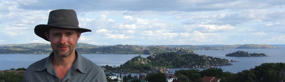
Photo op before I set off. My running buddy was unable to make it so my travelling companion for the day is a monkey, albeit the Beanie Baby variety! I’m starting from the northernmost part of the city’s administrative boundary and circling clockwise back to my start point, a distance of approximately 35 miles.

09:00
Slippy lanes and back roads do their very best to impede my attempts to move fast and keep the cold at bay. Already I’ve realised that navigating the route is not as easy as I thought: one small section of the route is rendered inaccessible by a large Private sign. I usually ignore this kind of nonsense but decide against this given that the sign is backed up by impenetrable hedges and barbed wire fencing. Clearly I need to improvise certain parts of the route and accept that I can’t plough through someone’s living room just because a line on a map appears to do so.

10:00
The ice is long gone producing a new enemy on off-road sections: thick, ankle-deep mud, the product of heavy rain and recent snow-melt. I may be walking the edges of a city but I’m clearly going to get mucky in the process. My Berghaus approach shoes, together with the bottoms of my walking trousers, are already caked with mud.

11:00
First stop of the day in a recreational field on the edge of a large housing estate. Just a few swigs of home-made energy drink, a few squares of chocolate and a couple of breakfast biscuits. The northern part of the city is almost rural but the landscape is already changing as I head into the densely populated eastern areas. Even so the map shows plenty of green space between the housing estates so I’m still hoping for a pleasant surprise or two along the way.

12:00 – 14:00
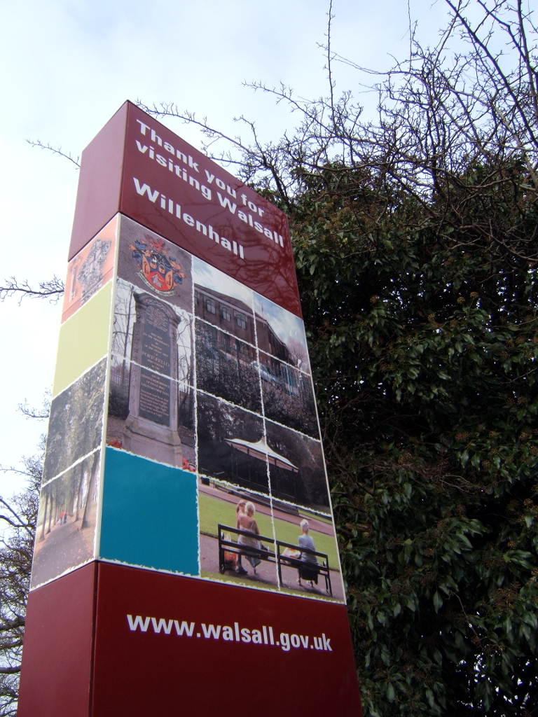
Very much aware that I’m in the middle of a fairly major conurbation now. An hour of threading my way though green space between housing estates brings me to the border between Wolverhampton and Willenhall and the first of a seemingly endless series of Welcome to Wolverhampton signs.
As I work my way through and around industrial units I realise that locals keep horses on the waste ground which surrounds these eyesores. Sadly, they’re all chained to prevent them wandering off and some appear to be in poor condition. Even so, to come across half-a-dozen horses grazing within a stone’s thrown of a major builder’s merchant is a touch surreal to say the least.

I stop for lunch on the banks of a canal at 1:30pm. Lunch itself is half a bag of beef jerky, a banana, more chocolate, some trail mix and a mug of coffee. I field test a Swedish Army gel cooker and am shocked by its performance: about 15 minutes to bring 400ml of water to the boil! I initially intended to heat more water to rehydrate a pasta ration but decide that time is against me. Fours hours in and I’m only one third of the way through: many miles and hours lie ahead.

14:00 – 16:00
Ever conscious that time is getting away from me I race down the canal, through the intriguingly-named Batmans Hill and skirt round Coseley as I work my way across Daisy Bank. I’m increasingly aware that it’ll be pretty much dark by 6pm and I have some semi-open rural sections ahead of me as I approach the southernmost parts of the boundary. I’m less concerned about navigating these sections in the dark as I am wading through the thick mud in the light of a head torch.
I still have plenty of energy but am aware that my knees and ankles are not as fresh as they were at 8am – a certain amount of stiffness has set in.

16:00 – 18:00
Horses, horses and yet more horses. It seems that Wolverhampton’s natives use every possible patch of green space to keep horses on. It reminds me of a story I once heard about kids in Northern Ireland keeping and riding horses in urban areas. I’m again a bit concerned about the condition of some of them: chained up, dirty, filmy-looking eyes. Who they belong to, and who tends to them, is anyone’s guess.

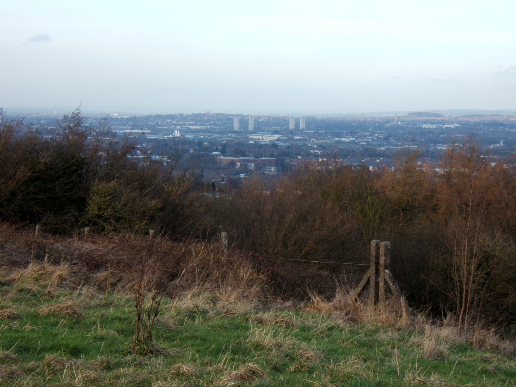
I push on against a steep and (at this stage) unwelcome incline towards the pleasantly grassy Cinder Hill.
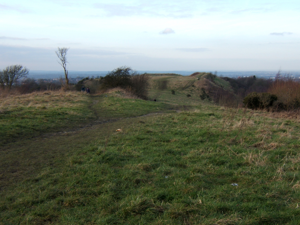
At 230 metres it’s one of the highest points in the area and, though a mere pimple, still offers panoramic views over the city and beyond.
Beyond Cinder Hill I’m faced with a series of open fields and an unwelcome return to ankle-deep mud. In my haste to get through this section before dark I make a stupid navigational error and follow my instincts rather than compass and map. I really ought to know better than this and, after realising my mistake, lose 25 minutes trying to pinpoint my exact position and get back on the correct path. I’m subsequently forced to socially engineer my way through private land as a consequence of taking a path that runs parallel to (but lower than) the path I ought to have taken. By the time I reach tarmac again (a country lane with no lighting) it’s too dark to read the map and I’m forced to resort to my head torch.

18:00 – 20:00
After 30 minutes of navigating dark country lanes and diving into hedges to avoid oncoming cars I find myself back in the suburbs. Conscious of the fact that I’m still only two-thirds of the way through I charge through the outskirts of Spring Hill, Penn, Castlecroft and Wightwick. My ancient point-and-shoot camera struggles to focus in the dark and with no photo duties to distract me I focus on putting one increasingly sore foot after the other. I’m feeling the pace now and my ankles and knees are sore. I can also feel the beginnings of a blister on the ball of my big toe. I decide to rest for 15 minutes, eat the remainder of my beef jerky and wash down a glucose tablet with some water. I toy with the idea of buying some chips but decide against this – if I eat anything substantial at this stage then the urge to sleep (and bail out by catching a taxi back to my car) could become overwhelming!
20:00 – 21:15
I’m now paying the price for my fast pace: my ankles are stiff and sore and I very definitely have a couple of large and painful blisters on my right foot. All I really want to do is flag down a passing taxi. I find myself alternating between congratulating myself for getting this far and and shouting at myself like a drill sergeant, urging myself to ignore the discomfort and carry on. I remind myself how far into this I am and how good it’ll feel to reach the car knowing that I’ve completed my little adventure in full – perhaps the first person ever to have done so. At this stage 1km on the map feels like 2km and the last two miles on roads I know well seem to take forever. I eventually reach the finish line – to the roar of a crowd that exists only in my own head – and collapse into my car, tired and sore but happy to have achieved my goal.
Postscript
My training is obviously paying dividends because I woke this morning and realised that I felt fine. So much so that I almost wished I’d taken up my friend’s offer of a cheeky half-marathon before breakfast! I sensibly declined the offer but hopefully I’ll be running tomorrow evening provided I can get this damn blister sorted out…
